
Torrent du Chagne
Sport, Pedestrian sports, Hiking itinerary
in Guillestre
7.3
km
3h
Medium
-
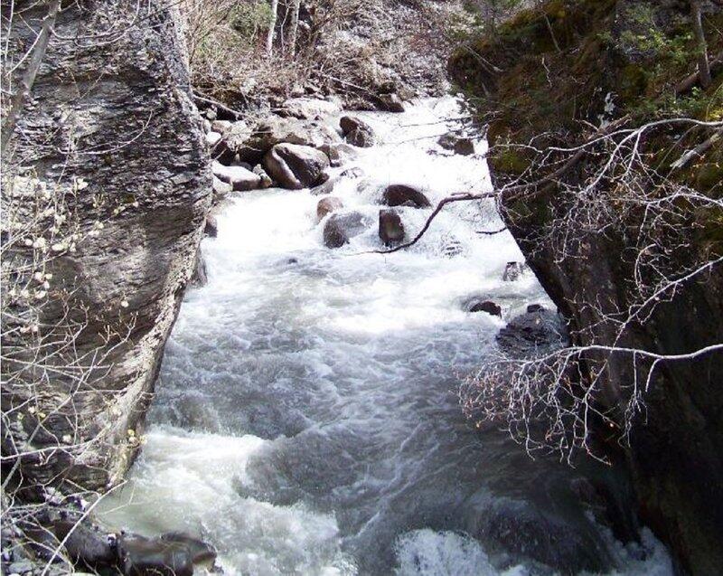
Leaving Guillestre, without using your car, let yourself be tempted by the tumultuous Chagne torrent that flows down from Vars. On the first section, follow an aerial balcony path, before entering the forest and its rural atmosphere.
-
This hike also offers a number of challenging climbs, with beautiful views over Guillestre, the hamlets of Vars and the surrounding massifs as far as the Écrins.
Of particular note is the characteristic layout and diversity of the plant species encountered, thanks to the succession of passages from adret to ubac. For the second part of the loop, cross the village of Risoul, which adds a touch of heritage to the hike, with its opulent farmhouses and mountain architecture. Return to...This hike also offers a number of challenging climbs, with beautiful views over Guillestre, the hamlets of Vars and the surrounding massifs as far as the Écrins.
Of particular note is the characteristic layout and diversity of the plant species encountered, thanks to the succession of passages from adret to ubac. For the second part of the loop, cross the village of Risoul, which adds a touch of heritage to the hike, with its opulent farmhouses and mountain architecture. Return to Guillestre, where you can sip a drink on the terrace while reminiscing about the roaring Chagne.
Please note: in winter, from Pont de Chanterane to Pont de Peyre Bartino, the route is a cross-country ski trail! It is therefore reserved exclusively for cross-country skiing.
In spring and autumn, conditions are changeable, and even without snow, the trail can be icy. So, in the mountains, the reflex to adopt is "go out well-equipped". In my bag, I slip or I hang: crampons and poles.
In winter, the right reflexes are: snowshoes, poles, gloves, hat, sun cream and... a survival blanket! Experience is essential, and knowing when to give up is sometimes preferable to taking risks. And if you're new to the mountains, we advise you to seek professional advice! Before going out, I check the Météo France Montagnes and BERA bulletins (risks and avalanches).
- Departure
- Guillestre
-
-
Difference in height
- 303.333 m
-
-
-
Plain text period
-
All year round daily.
Subject to favorable snow and weather conditions.
-
-
-
Spoken languages
-
-
-
-
-
Documentation
- GPX / KML files allow you to export the trail of your hike to your GPS (or other navigation tool)
-
- 303 meters of difference in height
-
- Maximum altitude : 1190 m
- Minimum altitude : 976 m
- Total positive elevation : 303 m
- Total negative elevation : -303 m
- Max positive elevation : 101 m
- Min positive elevation : -188 m
Services
-
-
Services
-


