
Pouit
Sport, Pedestrian sports, Hiking itinerary
in Saint-Crépin
7.4
km
4h
Medium
-
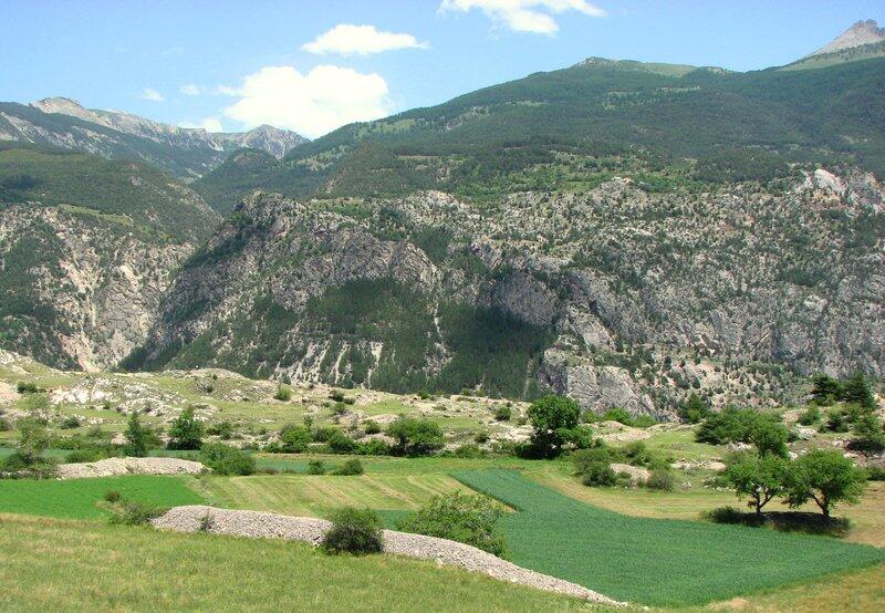
A gentle steppe named Puit.
Some hikes that bring a smile to your face just because of their name, and this is the case with Le Pouit. Right away, the landscape becomes steppe-like: bushes, small trees and pastures offer an unobstructed view over the Durance. -
You'd think you were in the scrubland if it weren't for the huge, shady mountains all around. On this dry, stony ground (be sure to bring sun cream and a cap!), there are still vestiges of the ancient Roman road. Follow the signposted path up to Champcella, then the GR 50 to the hamlet of Ponteil, then back down to the starting point via Le Gouas. You can shorten the itinerary by going directly to Gouas from Champcella via the dead-end road.
Please note: in winter, from Pont de Chanterane...You'd think you were in the scrubland if it weren't for the huge, shady mountains all around. On this dry, stony ground (be sure to bring sun cream and a cap!), there are still vestiges of the ancient Roman road. Follow the signposted path up to Champcella, then the GR 50 to the hamlet of Ponteil, then back down to the starting point via Le Gouas. You can shorten the itinerary by going directly to Gouas from Champcella via the dead-end road.
Please note: in winter, from Pont de Chanterane to Pont de Peyre Bartino, the route is a cross-country ski trail! It is therefore reserved exclusively for cross-country skiing.
In spring and autumn, conditions are changeable, and even without snow, the trail can be icy. So, in the mountains, the reflex to adopt is "go out well-equipped". In my bag, I slip or I hang: crampons and poles.
In winter, the right reflexes are: snowshoes, poles, gloves, hat, sun cream and... a survival blanket! Experience is essential, and knowing when to give up is sometimes preferable to taking risks. And if you're new to the mountains, we advise you to seek professional advice! Before going out, I check the Météo France Montagnes and BERA bulletins (risks and avalanches).
- Departure
- Saint-Crépin
-
-
Difference in height
- 505 m
-
-
-
Plain text period
-
All year round daily.
Subject to favorable snow and weather conditions.
-
-
-
Spoken languages
-
-
-
-
-
Documentation
- GPX / KML files allow you to export the trail of your hike to your GPS (or other navigation tool)
-
- 505 meters of difference in height
-
- Maximum altitude : 1471 m
- Minimum altitude : 973 m
- Total positive elevation : 505 m
- Total negative elevation : -510 m
- Max positive elevation : 252 m
- Min positive elevation : -492 m
Services
-
-
Services
-


