
Les genévriers Thurifères
Sport, Pedestrian sports, Hiking itinerary
in Saint-Crépin
4.8
km
2h 30min
Medium
-
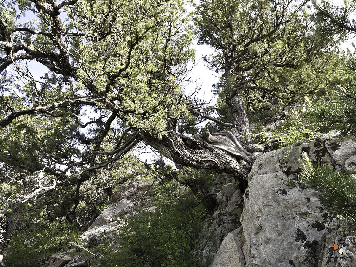
Phantasmagorical trees at the drop of a hat!
""What kind of alien name is that,"" you're probably wondering... And you're right about one thing: junipers are extra and from somewhere else! -
There's no need to scour the area to find this endemic species of remarkable tree, usually found only in the Moroccan Atlas.
From the village of Saint-Crépin, take a leisurely stroll up the path through this unique forest. The twisted, robust shape of the junipers makes them the kings of photo breaks! Each tree seems to come alive, like the impressive elephant, the doyenne of the bark. This itinerary has been laid out as an interpretation trail, so you can record lots of interesting...There's no need to scour the area to find this endemic species of remarkable tree, usually found only in the Moroccan Atlas.
From the village of Saint-Crépin, take a leisurely stroll up the path through this unique forest. The twisted, robust shape of the junipers makes them the kings of photo breaks! Each tree seems to come alive, like the impressive elephant, the doyenne of the bark. This itinerary has been laid out as an interpretation trail, so you can record lots of interesting information. The medieval village of Saint-Crépin, with its rich architectural and vernacular heritage, is also well worth a visit.
In winter, from Pont de Chanterane to Pont de Peyre Bartino, the route is a cross-country ski trail! It is therefore reserved exclusively for cross-country skiing.
In spring and autumn, conditions are changeable, and even without snow, the trail can be icy. So, in the mountains, the reflex to adopt is "go out well-equipped". In my bag, I slip or I hang: crampons and poles.
In winter, the right reflexes are: snowshoes, poles, gloves, hat, sun cream and... a survival blanket! Experience is essential, and knowing when to give up is sometimes preferable to taking risks. And if you're new to the mountains, we advise you to seek professional advice! Before going out, I check the Météo France Montagnes and BERA bulletins (risks and avalanches).
- Departure
- Saint-Crépin
-
-
Difference in height
- 377.667 m
-
-
-
Plain text period
-
All year round daily.
Subject to favorable snow and weather conditions.
-
-
-
Spoken languages
-
-
-
-
-
Documentation
- GPX / KML files allow you to export the trail of your hike to your GPS (or other navigation tool)
-
- 378 meters of difference in height
-
- Maximum altitude : 1302 m
- Minimum altitude : 926 m
- Total positive elevation : 378 m
- Total negative elevation : -378 m
- Max positive elevation : 363 m
- Min positive elevation : -266 m
Services
-
-
Services
-


