
Les crêtes de Gilly et de Peyra Plata
Sport, Pedestrian sports, Hiking itinerary
in Abriès-Ristolas
14.6
km
5h
Hard
-
A feast for the eyes!
-
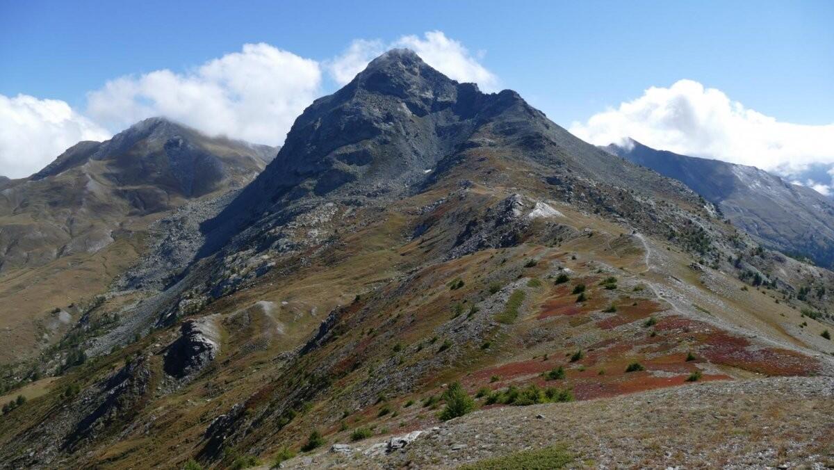
For the more courageous, departure from Ristolas along the GR58 signposted path towards Collette de Gilly. Along the way, on the right, the Etang du Moussou offers a well-deserved break. For the rest of you, the Gilly chairlift, in the summer season, gives you 500m more vertical gain, a great advantage for this aerial hike!
From the chairlift, take the path opposite towards Collette de Gilly, then follow the ridge line to the right, a variant of the GR58. The bonus: a 360° view of the...For the more courageous, departure from Ristolas along the GR58 signposted path towards Collette de Gilly. Along the way, on the right, the Etang du Moussou offers a well-deserved break. For the rest of you, the Gilly chairlift, in the summer season, gives you 500m more vertical gain, a great advantage for this aerial hike!
From the chairlift, take the path opposite towards Collette de Gilly, then follow the ridge line to the right, a variant of the GR58. The bonus: a 360° view of the surrounding peaks, and even further afield if the sky is clear: a breathtaking panorama! From the Peyra Plata ridge, descend to the hamlet of La Monta. Return to Abriès or Ristolas on the free Escarton shuttle bus (during summer school vacations), or on foot along the left bank of the Guil.
In winter, from Pont de Chanterane to Pont de Peyre Bartino, the route is a cross-country ski trail! It is therefore reserved exclusively for cross-country skiing.
In spring and autumn, conditions are changeable, and even without snow, the trail can be icy. So, in the mountains, the reflex to adopt is "go out well-equipped". In my bag, I slip or I hang: crampons and poles.
In winter, the right reflexes are: snowshoes, poles, gloves, hat, sun cream and... a survival blanket! Experience is essential, and knowing when to give up is sometimes preferable to taking risks. And if you're new to the mountains, we advise you to seek professional advice! Before going out, I check the Météo France Montagnes and BERA bulletins (risks and avalanches).
- Departure
- Abriès-Ristolas
-
-
Difference in height
- 600.01 m
-
-
-
Plain text period
-
All year round daily.
Subject to favorable snow and weather conditions.
-
-
-
Spoken languages
-
-
-
-
-
Documentation
- GPX / KML files allow you to export the trail of your hike to your GPS (or other navigation tool)
-
- 600 meters of difference in height
-
- Maximum altitude : 2566 m
- Minimum altitude : 1544 m
- Total positive elevation : 600 m
- Total negative elevation : -1061 m
- Max positive elevation : 512 m
- Min positive elevation : -724 m
Services
-
-
Equipment
-
-
-
Services
-


