
Le hameau du Chalvet des Borels
Sport, Pedestrian sports, Hiking itinerary
in Aiguilles
6.2
km
3h
Medium
-
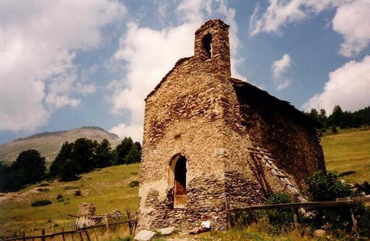
Old stones in the middle of the mountain pasture!
-
At the first bend in the road from La Condamine to Aiguilles, go straight ahead and follow the yellow signs to Meyriès. The track becomes a red-and-white signposted path through the forest. When you reach the forest road, turn right towards Chalvet des Borels, then right again towards the chapel donated by Louis XIV. The landscape opens out onto a former alpine pasture where all that remains is a ruined sheepfold and the chapel, restored to its original stone and wood design. The beauty and...
At the first bend in the road from La Condamine to Aiguilles, go straight ahead and follow the yellow signs to Meyriès. The track becomes a red-and-white signposted path through the forest. When you reach the forest road, turn right towards Chalvet des Borels, then right again towards the chapel donated by Louis XIV. The landscape opens out onto a former alpine pasture where all that remains is a ruined sheepfold and the chapel, restored to its original stone and wood design. The beauty and tranquility of the site are worth a freeze frame, with the Peynin valley and surrounding peaks opposite. Return by the same route.
In spring and autumn, conditions are changeable, and even snow-free trails can be icy. As a result, the reflex in the mountains is to "go out well equipped". In my bag, I slip or I hang: crampons and poles.
In winter, the right reflexes are: snowshoes, poles, gloves, hat, sun cream and... a survival blanket! Experience is essential, and knowing when to give up is sometimes preferable to taking risks. And if you're new to the mountains, don't hesitate to call in a professional! Before going out, I check the Météo France Montagnes and BERA bulletins (risks and avalanches).
- Departure
- Aiguilles
-
-
Difference in height
- 403 m
-
-
-
Plain text period
-
All year round daily.
Subject to favorable snow and weather conditions.
-
-
-
Spoken languages
-
-
-
-
-
Documentation
- GPX / KML files allow you to export the trail of your hike to your GPS (or other navigation tool)
-
- 403 meters of difference in height
-
- Maximum altitude : 1861 m
- Minimum altitude : 1461 m
- Total positive elevation : 403 m
- Total negative elevation : -412 m
- Max positive elevation : 393 m
- Min positive elevation : -331 m
Services
-
-
Equipment
-
-
-
Services
-


