
Le col Saint-Martin ou le col d'Abriès
Sport, Pedestrian sports, Hiking itinerary
in Abriès-Ristolas
15.4
km
6h
Quite difficult
-
A border pass that inspires exchange!
-
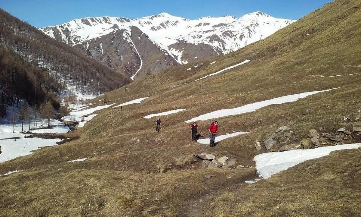
At the end of Le Roux, continue on a track that leads to the Saint-Antoine chapel. Take the path on the right towards Col Saint-Martin. After a short climb to warm up, the path crosses a lovely mélézin to reach the torrent. Walk alongside it, then cross it to enter the alpine pasture. If you look up the walls to the left, you may spot chamois. The sheepfold is a little further up on the left. The flock of ewes may not be far away. The final winding slope is steep (ouch my legs) and mineral....
At the end of Le Roux, continue on a track that leads to the Saint-Antoine chapel. Take the path on the right towards Col Saint-Martin. After a short climb to warm up, the path crosses a lovely mélézin to reach the torrent. Walk alongside it, then cross it to enter the alpine pasture. If you look up the walls to the left, you may spot chamois. The sheepfold is a little further up on the left. The flock of ewes may not be far away. The final winding slope is steep (ouch my legs) and mineral. At the pass, Italy opens up to you! You can already see the polenta dish waiting for you at the Lago Verde refuge, but don't forget the way back... by the same route, it's the easiest way!
In spring and autumn, conditions can change, and even snow-free trails can be icy. So, in the mountains, the reflex to adopt is "go out well equipped". In my bag, I slip or hang crampons and poles.
In winter, the right reflexes are: snowshoes, poles, gloves, hat, sun cream and... a survival blanket! Experience is essential, and knowing when to give up is sometimes preferable to taking risks. And if you're new to the mountains, don't hesitate to call in a professional! Before going out, I check the Météo France Montagnes and BERA bulletins (risks and avalanches).
- Departure
- Abriès-Ristolas
-
-
Difference in height
- 890.969 m
-
-
- Parking at Le Roux
-
-
Plain text period
-
All year round daily.
Subject to favorable snow and weather conditions.
-
-
-
Spoken languages
-
-
-
-
-
Documentation
- GPX / KML files allow you to export the trail of your hike to your GPS (or other navigation tool)
-
- 891 meters of difference in height
-
- Maximum altitude : 2652 m
- Minimum altitude : 1765 m
- Total positive elevation : 891 m
- Total negative elevation : -885 m
- Max positive elevation : 384 m
- Min positive elevation : -299 m
Services
-
-
Equipment
-
-
-
Services
-


