Description
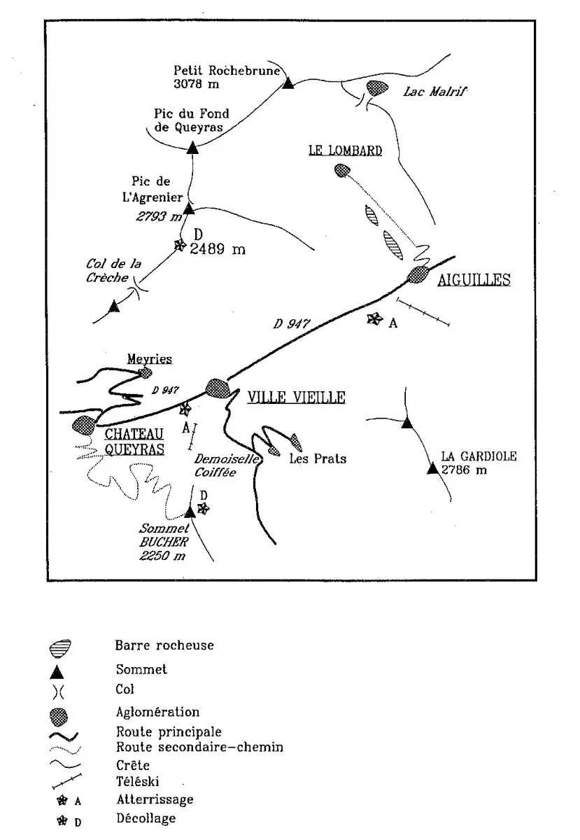
Access : at Château-Ville-Vieille, take the road to Meyriès.
At the parking of Meyriès, turn left, then after 250m take the forest road of Bois Noir. Stop before the end of the track, under the shoulder near a small stream, then 1h walk.
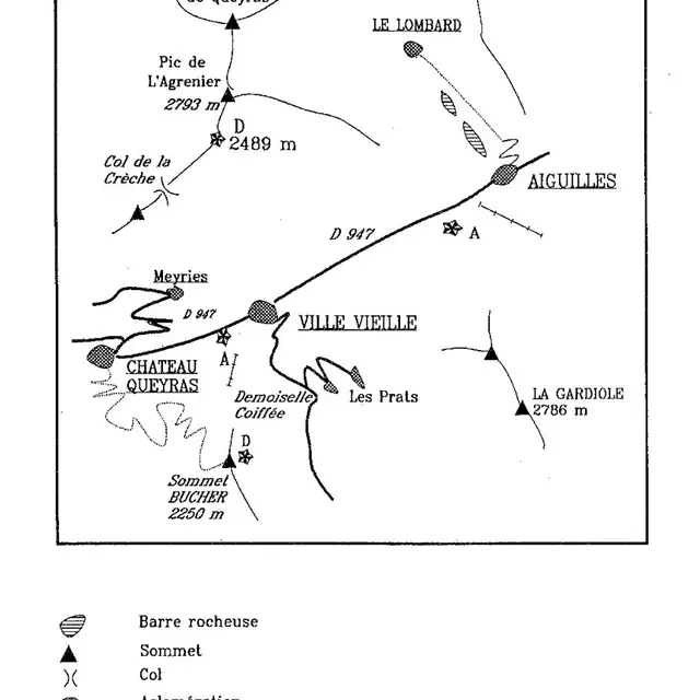
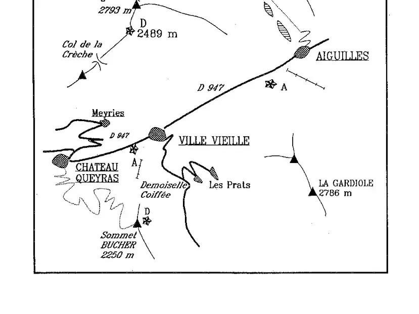
- Take off : L'Agrenier
- Orientation : South
- Altitude : 2500m
- Difference in altitude : 1100m
- Finesse : 3 for Ville-Vieille; 4.5 for Aiguilles.
- Favourable conditions : South and breeze.
- Landing : Ville-Vieille (1400m), in the Rua; lower road.
Aiguilles (1450m), temporary landing, ask for information.
- Danger and difficulty: mountain flight, be careful with the valley breeze for the landing.