
La Rue des Masques
Sport, Pedestrian sports, Hiking itinerary
in Guillestre
7.1
km
3h
Medium
-
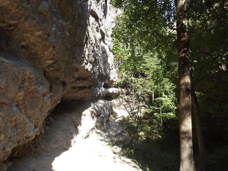
Does the name of this hike intrigue you? From collapsed canyons, plunging into the rocky chaos of the Rue des Masques, place of legends and sorcerers (and famous climbing site!), to the water of the Guil, to finish on the vast grassy plateaus of the Simoust!
-
The loop circles the Guillestre plateau, passing at the foot of the Pain de Sucre and via the Simoust road, the Guil gorges, with fine views of the Mont-Dauphin stronghold and the village of Eygliers.
A passage through a canyon haunted by legends winds its way between collapsed rocks eroded by time, before descending to the foot of the Buffalorum waterfall in a wilderness setting. The street name "Les Masques" comes from the Provençal word "Masco", meaning sorcerers...
In spring and autumn,...The loop circles the Guillestre plateau, passing at the foot of the Pain de Sucre and via the Simoust road, the Guil gorges, with fine views of the Mont-Dauphin stronghold and the village of Eygliers.
A passage through a canyon haunted by legends winds its way between collapsed rocks eroded by time, before descending to the foot of the Buffalorum waterfall in a wilderness setting. The street name "Les Masques" comes from the Provençal word "Masco", meaning sorcerers...
In spring and autumn, conditions are changeable, and even snow-free trails can be icy. As a result, the reflex in the mountains is to "go out well equipped". In my bag, I slip or I hang: crampons and poles.
In winter, the right reflexes are: snowshoes, poles, gloves, hat, sun cream and... a survival blanket! Experience is essential, and knowing when to give up is sometimes preferable to taking risks. And if you're new to the mountains, don't hesitate to call in a professional! Before going out, I check the Météo France Montagnes and BERA bulletins (risks and avalanches).
- Departure
- Guillestre
-
-
Difference in height
- 199.333 m
-
-
-
Plain text period
-
All year round daily.
Subject to favorable snow and weather conditions.
-
-
-
Spoken languages
-
-
-
-
-
Documentation
- GPX / KML files allow you to export the trail of your hike to your GPS (or other navigation tool)
-
- 199 meters of difference in height
-
- Maximum altitude : 1094 m
- Minimum altitude : 939 m
- Total positive elevation : 199 m
- Total negative elevation : -199 m
- Max positive elevation : 67 m
- Min positive elevation : -88 m
Services
-
-
Services
-


