
La rando en Gros
Sport, Pedestrian sports, Hiking itinerary
in Eygliers
4.0
km
1h 45min
Easy
-
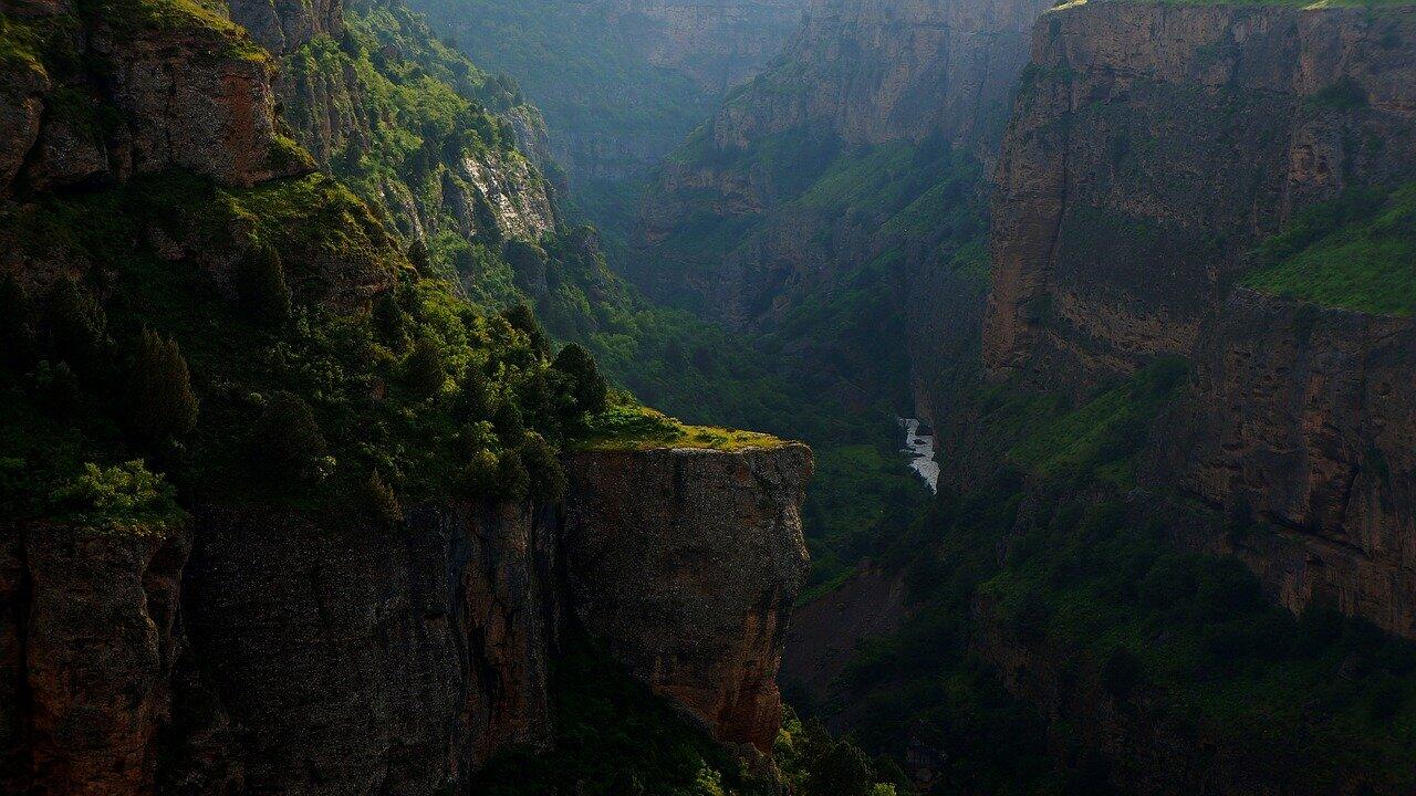
The hamlet of Gros offers unrivalled views over the entire valley! The Queyras gorges will hold no more secrets for you ! Stop off at the fresco chapel to recharge your batteries in its peaceful air.
-
The small access road to the hamlet is in itself a remarkable asset. Stop at the viewpoints with benches to enjoy the unprecedented dominance of the Guillestrois. Park at the hamlet alongside a field. From here, walk down alongside the frescoed chapel (a must-see!), then take the path down through the hedges to the gravel track. Go up to the right and enjoy the view over the tunnels of the Queyras gorges and the almost aerial view of Guillestre and Mont-dauphin. Back on the road, turn right...
The small access road to the hamlet is in itself a remarkable asset. Stop at the viewpoints with benches to enjoy the unprecedented dominance of the Guillestrois. Park at the hamlet alongside a field. From here, walk down alongside the frescoed chapel (a must-see!), then take the path down through the hedges to the gravel track. Go up to the right and enjoy the view over the tunnels of the Queyras gorges and the almost aerial view of Guillestre and Mont-dauphin. Back on the road, turn right to get back to the car. Here, take the track towards Refuge de Furfande. The pine forest provides welcome shade. If you see the antenna, continue on to it, where the Cristillan valley towards Ceillac opens up before you. Return along the same track to the car.
In spring and autumn, conditions are changeable, and even snow-free trails can be icy. As a result, the reflex in the mountains is to "go out well equipped". In my bag, I slip or I hang: crampons and poles.
In winter, the right reflexes are: snowshoes, poles, gloves, hat, sun cream and... a survival blanket! Experience is essential, and knowing when to give up is sometimes preferable to taking risks. And if you're new to the mountains, don't hesitate to call in a professional! Before going out, I check the Météo France Montagnes and BERA bulletins (risks and avalanches).
- Departure
- Eygliers
-
-
Difference in height
- 177 m
-
-
-
Plain text period
-
All year round daily.
Subject to favorable snow and weather conditions.
-
-
-
Spoken languages
-
-
-
-
-
Documentation
- GPX / KML files allow you to export the trail of your hike to your GPS (or other navigation tool)
-
- 177 meters of difference in height
-
- Maximum altitude : 1444 m
- Minimum altitude : 1304 m
- Total positive elevation : 177 m
- Total negative elevation : -177 m
- Max positive elevation : 89 m
- Min positive elevation : -78 m
Services
-
-
Services
-


