
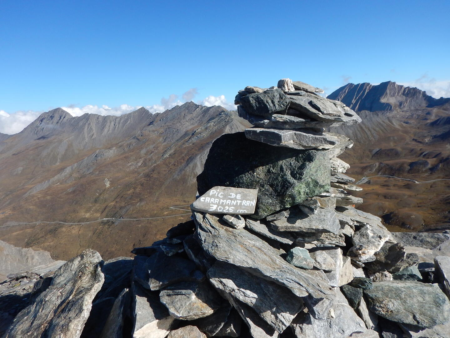
Pic de Caramantran par le col de Chamoussière
Sport, Pedestrian sports, Hiking itinerary
in Molines-en-Queyras
6.7
km
3h 30min
Medium
-
The Pic de Caramantran (3025 m) is a relatively accessible 3000 m hike which offers a very beautiful view on the Mont Viso, the Pain de Sucre, the Tête des Toillies...
-
Park in the large parking lot 300 m after the Refuge, continuing towards Col Agnel. Take the GR58 to the Col de Chamoussière. From this point onwards, there are no markings, but numerous cairns allow you to reach the summit. From the col, head south then south-east.
The rest of the ridge is more challenging, so it's best to return by the same route.
In winter, from Pont de Chanterane to Pont de Peyre Bartino, the route is a cross-country ski trail! It is therefore exclusively reserved for...Park in the large parking lot 300 m after the Refuge, continuing towards Col Agnel. Take the GR58 to the Col de Chamoussière. From this point onwards, there are no markings, but numerous cairns allow you to reach the summit. From the col, head south then south-east.
The rest of the ridge is more challenging, so it's best to return by the same route.
In winter, from Pont de Chanterane to Pont de Peyre Bartino, the route is a cross-country ski trail! It is therefore exclusively reserved for cross-country skiing.
In spring and autumn, conditions are changeable, and even without snow, the trail can be icy. So, in the mountains, the reflex to adopt is "go out well-equipped". In my bag, I slip or I hang: crampons and poles.
In winter, the right reflexes are: snowshoes, poles, gloves, hat, sun cream and... a survival blanket! Experience is essential, and knowing when to give up is sometimes preferable to taking risks. And if you're new to the mountains, we advise you to seek professional advice! Before going out, I check the Météo France Montagnes and BERA bulletins (risks and avalanches).
In summer, the marauders of the PNR du Queyras welcome you to their chalet on the parking lot.
- Departure
- Molines-en-Queyras
-
-
Difference in height
- 386.793 m
-
-
- Parking lot located 300 m after the refuge on the way up to the Col Agnel.
-
-
Spoken languages
-
-
-
-
-
Documentation
- GPX / KML files allow you to export the trail of your hike to your GPS (or other navigation tool)
-
- 387 meters of difference in height
-
- Maximum altitude : 2972 m
- Minimum altitude : 2588 m
- Total positive elevation : 387 m
- Total negative elevation : -387 m
- Max positive elevation : 215 m
- Min positive elevation : -213 m
Services
-
-
Equipment
-
-
-
Services
-


