
7 - Du Guil au Pain de sucre en VTT
Sport, Cycling sports, Mountain biking itinerary
in Guillestre
11.6
km
1h 45min
Medium
-
A beautiful itinerary between river, heritage and 360° views!
-
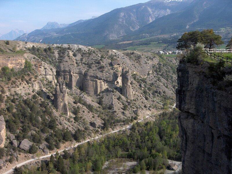
It's a gentle, varied stroll from the narrow streets of Guillestre to the orchards and fields of the Gaboyer agricultural plateau, where the surrounding peaks come into view. You then join the turquoise waters of the Guil, which you climb up under the imposing Mont-Dauphin cliff. The trail takes you up to Pain de Sucre (not to be confused with its illustrious namesake at Col Agnel), whose relief offers exceptional views over the Guillestrois region.
The itinerary runs along a cliff,...It's a gentle, varied stroll from the narrow streets of Guillestre to the orchards and fields of the Gaboyer agricultural plateau, where the surrounding peaks come into view. You then join the turquoise waters of the Guil, which you climb up under the imposing Mont-Dauphin cliff. The trail takes you up to Pain de Sucre (not to be confused with its illustrious namesake at Col Agnel), whose relief offers exceptional views over the Guillestrois region.
The itinerary runs along a cliff, requiring careful attention.
- Departure
- Guillestre
-
-
Difference in height
- 266.333 m
-
-
-
Plain text period
- From 01/06 to 01/11 daily.
-
-
-
Spoken languages
-
-
-
-
-
Documentation
- GPX / KML files allow you to export the trail of your hike to your GPS (or other navigation tool)
-
- 266 meters of difference in height
-
- Maximum altitude : 1097 m
- Minimum altitude : 905 m
- Total positive elevation : 266 m
- Total negative elevation : -266 m
- Max positive elevation : 178 m
- Min positive elevation : -85 m


