
Crête de Curlet
Sport, Pedestrian sports, Hiking itinerary
in Saint-Véran
7.9
km
4h
Hard
-
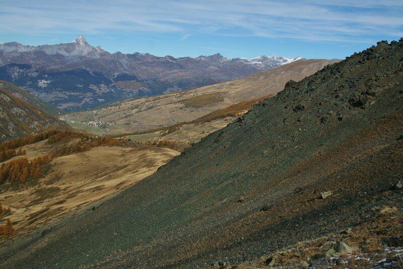
Overlooking St Véran from the opposite side!
-
It's a fairly sporty outing, where you'll be swallowing up ascent and descent over a short distance! But the view is so beautiful that you'll soon forget about it! Descend to the hamlet of Le Raux, then cross the Aigue Blanche torrent at the Pont du Moulin. The path winds steadily upwards through a beautiful larch forest to reach the Lamaron hut. The path bends to the left and soon the Croix de Curlet rises up. The best possible view of Saint-Véran! Energy to spare? You can extend the hike...
It's a fairly sporty outing, where you'll be swallowing up ascent and descent over a short distance! But the view is so beautiful that you'll soon forget about it! Descend to the hamlet of Le Raux, then cross the Aigue Blanche torrent at the Pont du Moulin. The path winds steadily upwards through a beautiful larch forest to reach the Lamaron hut. The path bends to the left and soon the Croix de Curlet rises up. The best possible view of Saint-Véran! Energy to spare? You can extend the hike by an hour by taking the Curlet ridge to Pic Cascavelier. Descend via a scree slope to the Lamaron hut. From there, return along the same path.
In spring and autumn, conditions are changeable, and even snow-free trails can be icy. As a result, the reflex in the mountains is to "go out well equipped". In my bag, I slip or hang crampons and poles.
In winter, the right reflexes are: snowshoes, poles, gloves, hat, sun cream and... a survival blanket! Experience is essential, and knowing when to give up is sometimes preferable to taking risks. And if you're new to the mountains, don't hesitate to call in a professional! Before going out, I check the Météo France Montagnes and BERA bulletins (risks and avalanches).
- Departure
- Saint-Véran
-
-
Difference in height
- 608.096 m
-
-
-
Plain text period
-
All year round daily.
Subject to favorable snow and weather conditions.
-
-
-
Spoken languages
-
-
-
-
-
Documentation
- GPX / KML files allow you to export the trail of your hike to your GPS (or other navigation tool)
-
- 608 meters of difference in height
-
- Maximum altitude : 2543 m
- Minimum altitude : 1871 m
- Total positive elevation : 608 m
- Total negative elevation : -653 m
- Max positive elevation : 352 m
- Min positive elevation : -2 m
Services
-
-
Services
-


