
Boucle des Balcons
Sport, Pedestrian sports, Hiking itinerary
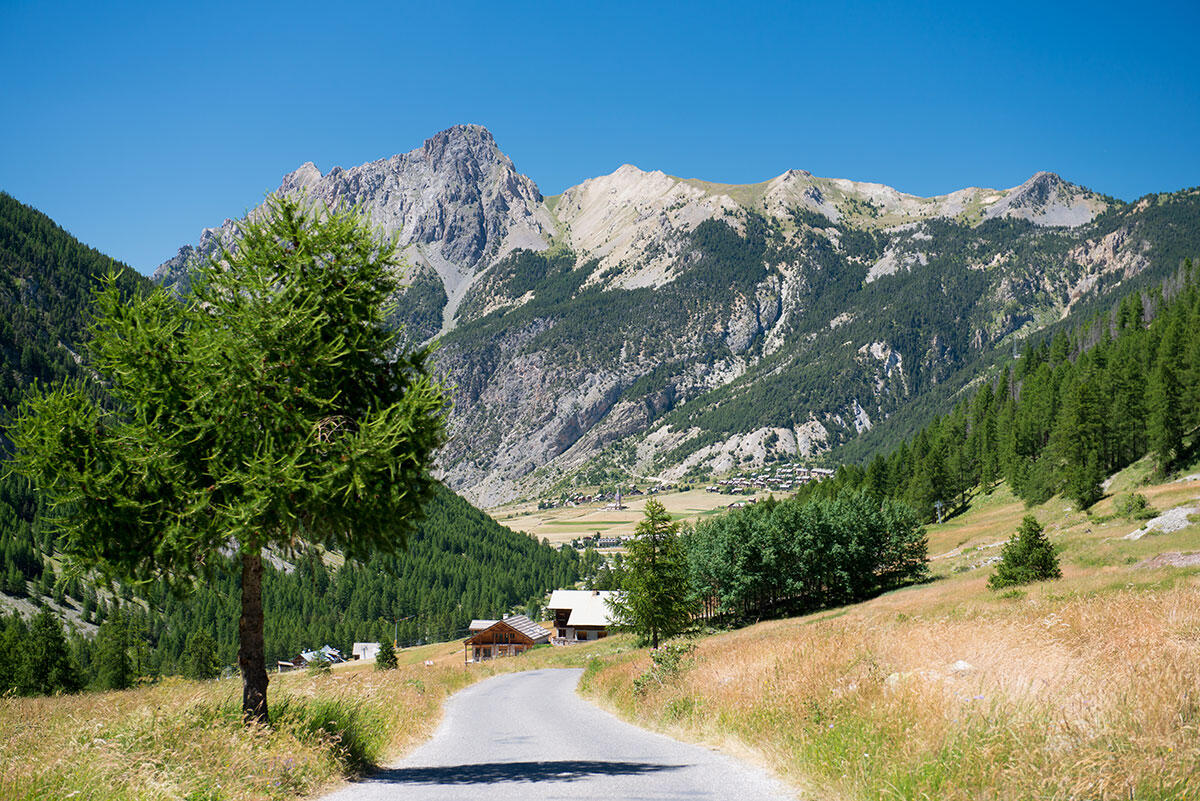
in Ceillac
5.5
km
1h 30min
Medium
-
A nice loop that starts in the village of Ceillac, leading you to the Sagnes, then to the Pied du Mélézet. The return path to the village runs along the Mélézet torrent, on the left bank.
-
There is a forestry worksite in progress, and the route from Cime du Mélézet to Chaurionde will be temporarily disrupted. The worksite is signposted with safety signs.
Communication panels on forest management are also in place.
The area will be restored and the slash treated at the end of the cut.
In spring and autumn, conditions are changeable, and even snow-free trails can be icy. As a result, the reflex in the mountains is to "go out well equipped". In my bag, I slip or I hang:...There is a forestry worksite in progress, and the route from Cime du Mélézet to Chaurionde will be temporarily disrupted. The worksite is signposted with safety signs.
Communication panels on forest management are also in place.
The area will be restored and the slash treated at the end of the cut.
In spring and autumn, conditions are changeable, and even snow-free trails can be icy. As a result, the reflex in the mountains is to "go out well equipped". In my bag, I slip or I hang: crampons and poles.
In winter, the right reflexes are: snowshoes, poles, gloves, hat, sun cream and... a survival blanket! Experience is essential, and knowing when to give up is sometimes preferable to taking risks. And if you're new to the mountains, don't hesitate to call in a professional! Before going out, I check the Météo France Montagnes and BERA bulletins (risks and avalanches).
- Departure
- Ceillac
-
-
Difference in height
- 141.333 m
-
-
-
Plain text period
-
Open every day.
Subject to favorable snow and weather conditions.
-
-
-
Spoken languages
-
-
-
-
-
Documentation
- GPX / KML files allow you to export the trail of your hike to your GPS (or other navigation tool)
-
- 141 meters of difference in height
-
- Maximum altitude : 1771 m
- Minimum altitude : 1635 m
- Total positive elevation : 141 m
- Total negative elevation : -141 m
- Max positive elevation : 109 m
- Min positive elevation : -74 m
Services
-
-
Services
-


