
Belvédère de l'Homme de Pierre
Sport, Pedestrian sports, Hiking itinerary
in Guillestre
11.2
km
5h
Medium
-
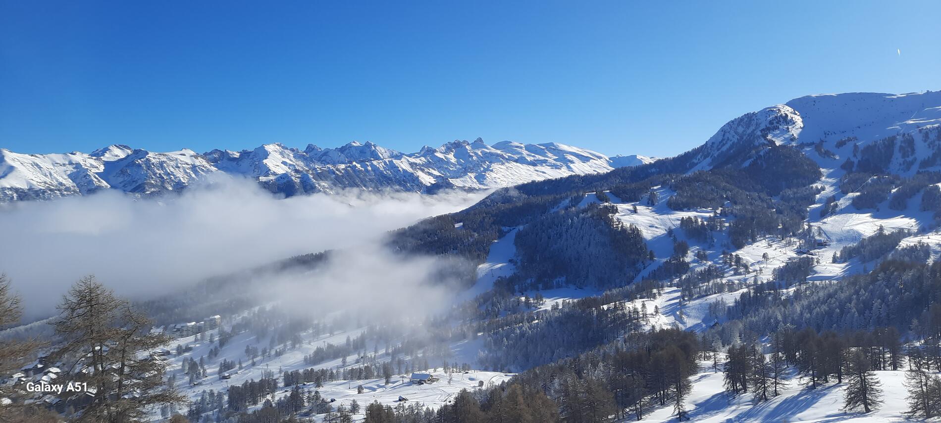
A 360° universe of stone.
-
From the Risoul 1850 resort snow front, the route climbs to the right to join the forest track leading to the Col de Chérine. After three hairpin bends away from the chalets, turn left to pick up the path that snakes through the forest. It becomes slightly steeper before reaching the bottom of a scree. Once you reach the ridge, the view opens up! The trail continues slightly downhill before climbing to the top of the ski slope. Belvedere objective reached! It's a sight to behold! The view is...
From the Risoul 1850 resort snow front, the route climbs to the right to join the forest track leading to the Col de Chérine. After three hairpin bends away from the chalets, turn left to pick up the path that snakes through the forest. It becomes slightly steeper before reaching the bottom of a scree. Once you reach the ridge, the view opens up! The trail continues slightly downhill before climbing to the top of the ski slope. Belvedere objective reached! It's a sight to behold! The view is panoramic, from the Razis crest to the Écrins massif, via the Serre-Ponçon lake, not forgetting the Aiguilles de Chabrières. The descent is via the same route.
In spring and autumn, conditions are changeable, and even snow-free trails can be icy. As a result, the reflex in the mountains is to "go out well equipped". In my bag, I slip or hang crampons and poles.
In winter, the right reflexes are: snowshoes, poles, gloves, hat, sun cream and... a survival blanket! Experience is essential, and knowing when to give up is sometimes preferable to taking risks. And if you're new to the mountains, don't hesitate to call in a professional! Before going out, I check the Météo France Montagnes and BERA bulletins (risks and avalanches).
- Departure
- Guillestre
-
-
Difference in height
- 559.656 m
-
-
-
Plain text period
-
Open every day.
Subject to favorable snow and weather conditions.
-
-
-
Spoken languages
-
-
-
-
-
Documentation
- GPX / KML files allow you to export the trail of your hike to your GPS (or other navigation tool)
-
- 560 meters of difference in height
-
- Maximum altitude : 2332 m
- Minimum altitude : 1894 m
- Total positive elevation : 560 m
- Total negative elevation : -560 m
- Max positive elevation : 308 m
- Min positive elevation : -192 m
Services
-
-
Services
-


