
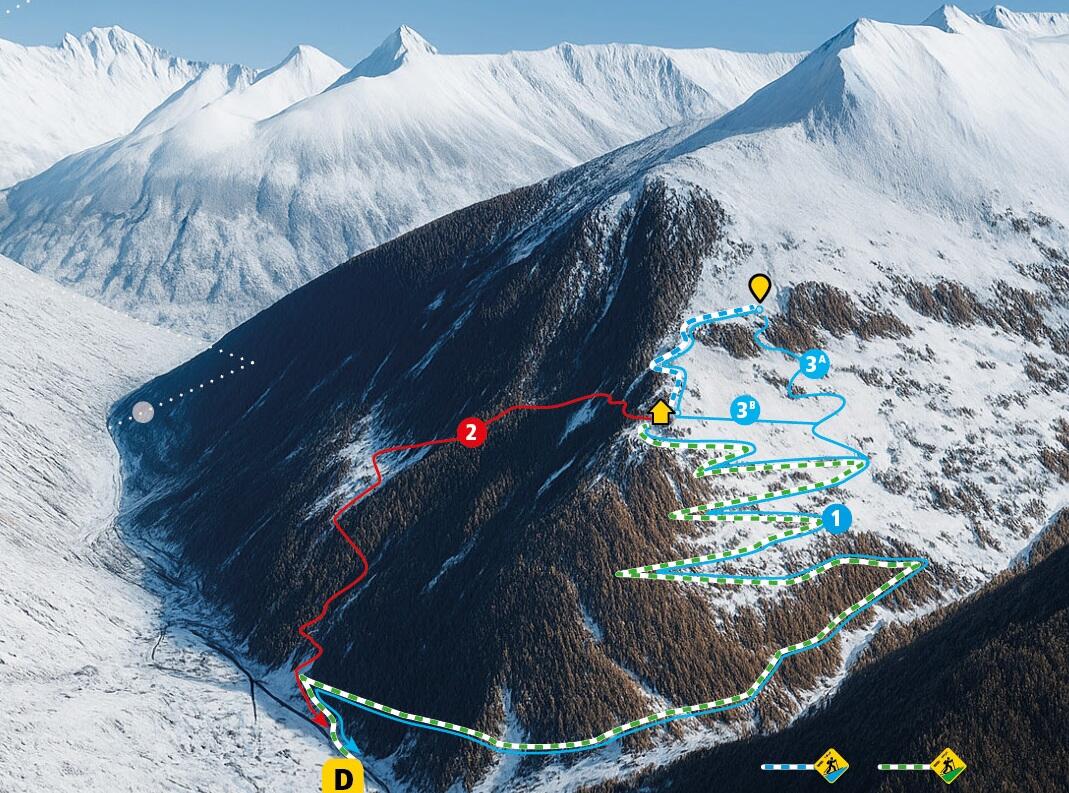
Itinéraire de ski de rando balisé - Aiguilles (Bleu)
Sport, Skiing, Ski touring route
in Aiguilles
5.6
km
Skiing
3h 30min
Medium
-
A signposted ascent and descent route on ungroomed slopes & 1 avalanche transceiver park to practice using your safety equipment (avalanche transceiver, shovel and probe).
-
Worth knowing:
- Keep up to date with weather and snow conditions
(posted at the Guillestrois-Queyras Tourist Office or on meteofrance.com).
- Respect safety instructions
- Wear personal and collective protective equipment (avalanche transceiver, shovel, probe, 1st aid kit, telephone, etc.).
- Assess your technical and physical abilities
- Respect directions of travel (ascents and descents)
- Departure
- Aiguilles
-
-
Difference in height
- 558.969 m
-
-
-
Plain text period
-
From 19/12/2025 to 30/04/2026 daily between 9 am and 4.30 pm.
Access forbidden during avalanche risk levels 4 and 5 and outside these times.
Subject to favorable snow and weather conditions.
-
-
-
Spoken languages
-
-
-
-
-
Documentation
- GPX / KML files allow you to export the trail of your hike to your GPS (or other navigation tool)
-
- 559 meters of difference in height
-
- Maximum altitude : 2012 m
- Minimum altitude : 1465 m
- Total positive elevation : 559 m
- Total negative elevation : -12 m
- Max positive elevation : 305 m
- Min positive elevation : -8 m


")
